How Are Green Belt Boundaries Changed?
How Are Green Belt Boundaries Changed? Understand the Green Belt permanence principle, boundary changes, exceptional circumstances and the August 2026 NPPF rules on Green Belt review.
GREEN BELTPLANNING POLICY
Andrew Ransome
8/23/20266 min read
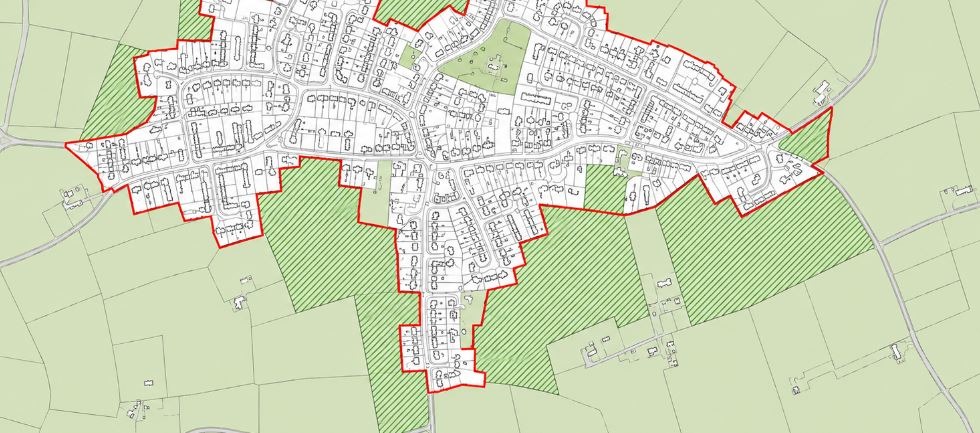
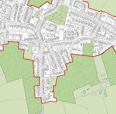
Green Belt boundaries are not fixed in perpetuity. They can be altered — but only through the development plan process.
The National Planning Policy Framework published in August 2026 has restructured Green Belt policy into a codified set of policies, GB1 to GB8, replacing the paragraph-based structure of the previous Framework.
The underlying principles will be familiar to anyone who has worked with Green Belt policy before — permanence, exceptional circumstances, a sequential approach to release.
But they are now expressed as distinct, numbered policies, and several genuinely new elements have been introduced, including a new route for altering boundaries around well-connected stations.
This article explains the process, the tests that apply, and what the August 2026 changes mean in practice.
The Green Belt 'Permanence' Principle
The objective set out at the start of Chapter 13 of the Framework confirms that the fundamental aim of Green Belt policy is to prevent urban sprawl by keeping land permanently open, and that the essential features of which are their openness and permanence.
Permanence remains one of the two essential characteristics of the Green Belt, and the core procedural consequence remains unchanged:
Green Belt boundaries cannot be altered through individual planning applications or appeal decisions.
Permission can be granted for development on Green Belt land through very special circumstances (policy GB6), or because the development falls within one of the categories that are not inappropriate in the Green Belt (policy GB7) — but in either case the land remains designated Green Belt.
Actual boundary alteration can only happen through the development plan process, subject to independent examination.
Establishing New Green Belts: Policy GB1
One genuinely new addition is policy GB1, which deals with the rare circumstance of establishing an entirely new Green Belt, for example when planning for new settlements or major urban extensions.
As the general extent of Green Belt land across the country is already established, this should only happen in exceptional circumstances.
Any proposal must demonstrate why major changes in circumstances make a new Green Belt necessary, why normal planning and development policies would be inadequate, and that the new Green Belt would be compatible with long-term growth ambitions for the area.
Assessing Existing Green Belt Land: Policy GB2
Policy GB2 now sets out a two-stage assessment process that feeds into any decision to alter a boundary.
At the strategic level, spatial development strategies should be informed by a strategic Green Belt assessment considering the strategy area against the five purposes of the Green Belt.
At the local plan level, preparation should be informed by a more detailed assessment, conducted in accordance with the process now set out in Annex E of the NPPF, which identifies grey belt land and informs any Green Belt boundary alterations that accord with policy GB3.
This is a significant change in itself: the methodology for identifying grey belt, previously found largely in planning practice guidance, has now been elevated into national policy through Annex E, giving it much greater weight in plan examinations and appeals.
Altering Existing Green Belt Boundaries: Policy GB3
Policy GB3 contains the core test for altering an existing boundary.
Boundaries should only be altered through the preparation and updating of local plans, and only where exceptional circumstances are fully evidenced and justified — subject to one important new exception discussed below.
Exceptional circumstances in this context include a local planning authority being unable to meet its identified development need in full, having examined all other reasonable options, including:
making as much use as possible of suitable previously developed and underutilised land;
optimising the density of development in accordance with policy L1; and
assessing whether sufficient suitable sites can be identified outside the Green Belt.
This preserves the substance of the previous test — an authority must show its workings before concluding that Green Belt release is justified.
A New Route: Well-Connected Stations
The most significant change introduced by policy GB3 is found at GB3(4). Where a development plan's spatial strategy can identifies suitable land around a well-connected station for development, exceptional circumstances do not need to be separately demonstrated to justify altering the Green Belt boundary.
This is a meaningful departure from the previous position.
Ordinarily, an authority proposing to release Green Belt land must build a full evidential case around unmet need and the exhaustion of alternatives.
This mirrors the new decision-making route for station-proximity development introduced at policy GB7(1)(h), and is likely to make sites within reasonable walking distance of stations with a good service frequency a particular focus for both plan-makers and site promoters over the coming years.
Defining Green Belt Boundaries: Policy GB4
Once the case for alteration is made, policy GB4 governs how the new boundary should actually be drawn.
Boundaries should only include land which it is necessary to keep permanently open, should be demonstrably consistent with the wider spatial strategy for accommodating growth, and should be defined using physical features that are readily recognisable and likely to be defensible.
The Sequential Approach to Release
Policy GB4(1)(d) retains the hierarchy for Green Belt release familiar from the previous Framework. Local plans should give priority to:
previously developed land within the Green Belt;
then grey belt land which is not previously developed; and
then other Green Belt locations,
so long as this promotes a sustainable pattern of development overall.
Boundary alterations should not be proposed where there is clear evidence they would fundamentally undermine the purposes of the remaining Green Belt, taken together, across the plan area.
Villages: Inset or Washed Over
Policy GB4(1)(b) and (c) address villages in the same way as the previous NPPF.
Where restricting development is necessary because of the important contribution a village's open character makes to the openness of the Green Belt, it should remain within the Green Belt and should not be identified as a "settlement" for the purposes of the spatial strategy.
Where a village's character needs protecting for other reasons — historic interest or landscape setting, for example — a different policy tool such as conservation area designation should be used instead, and the village excluded from the Green Belt.
Safeguarded Land
Policy GB4(1)(g) carries forward the concept of safeguarded land. Areas identified, where necessary, to meet longer-term development needs well beyond the plan period.
Safeguarded land is not allocated for development at the present time, does not form part of a settlement, and its status will change only when the plan is updated and proposes that the land is released.
For landowners, safeguarded status remains a significant form of long-term planning gain — the Green Belt constraint is lifted in principle, even though the timing of actual development is deferred to a future plan review.
The Golden Rules Link
A new cross-reference at policy GB4(1)(e) requires local plans to ensure that any allocation for major housing development on land released from the Green Belt can meet the Golden Rules set out in policy GB8 — covering affordable housing, infrastructure contributions and accessible green space — and that these requirements are set out clearly within the plan itself.
This ties the boundary-definition stage directly to the decision-making requirements that will later apply to individual planning applications on the released land, and is worth factoring into any early promotion strategy.
Green Belt Boundary Changes: Summary
Green Belt boundaries can still only be altered through the development plan process, and only on the basis of exceptional circumstances that are fully evidenced and justified — with one important exception. Where a spatial strategy has identified suitable land around a well-connected station, that evidential burden falls away under policy GB3(4).
The August 2026 Framework retains the sequential hierarchy prioritising previously developed land, then grey belt, then other Green Belt land, and continues to allow for safeguarded land as a mechanism for longer-term release.
What has changed is the structure and rigour behind these decisions: grey belt identification now follows a defined methodology set out in Annex E, and boundary definition is now explicitly linked to the Golden Rules that will apply once land is released.
For landowners promoting sites, early engagement in the local plan process, together with a robust Annex E-compliant evidence base demonstrating a weak contribution to Green Belt purposes, remains the foundation of any successful promotion
And, for sites near stations, understanding whether the new GB3(4) and GB7(1)(h) routes apply should now be one of the first questions asked.
Planning Application Advice
If you own land or a building in the Green Belt and want to understand your development options under the new 2026 NPPF, I can advise on planning strategy and manage your application or plan-promotion case from initial assessment through to decision. Contact me to discuss your site.
Andrew Ransome MRTPI - Email: andrew@andrewransome.co.uk
About me
Andrew Ransome is a Planning Director and a Chartered Member of the Royal Town Planning Institute (RTPI), with more than two decades of experience in town planning.
He specialises in delivering strategic planning solutions for complex developments across both rural and urban environments, helping clients navigate planning challenges and unlock development opportunities. Connect with Andrew on Linkedin.


Green Belt Information
Green Belt Approvals


Get in Touch
Email: andrew@andrewransome.co.uk
Tel: 020 7096 8045
London Office:
60 Tottenham Court Road
Fitzrovia
London
W1T 2EW
© 2026 Andrew Ransome Town Planning Ltd. All rights reserved.
Content on this website is provided for general information and educational purposes only and does not constitute formal planning, professional, or legal advice. Planning policies, legislation, and guidance are subject to change. Site-specific assessment by a qualified consultant is recommended before making development decisions.
Projects highlighted across this website represent professional work undertaken by Andrew Ransome throughout his career.