What Does Openness in the Green Belt Mean?
Guide to Green Belt openness under the NPPF, covering spatial and visual openness, preservation tests, Previously Developed Land, and key UK planning case law.
GREEN BELT
Andrew Ransome
8/25/202610 min read
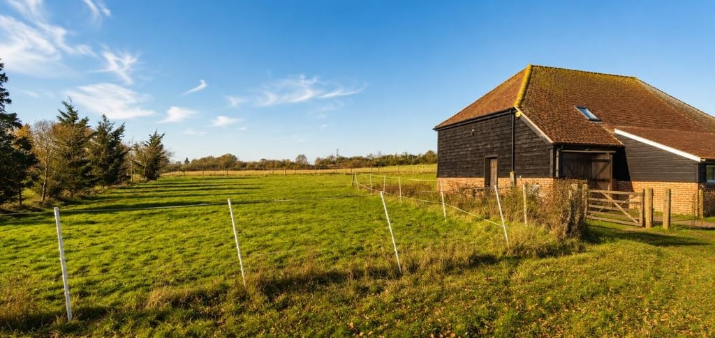
Openness is the defining characteristic of the Green Belt. It is the concept against which almost every Green Belt planning decision — at application stage, at appeal, and at local plan examination — must be assessed.
Yet for a term so central to Green Belt policy, it is undefined.
The National Planning Policy Framework (NPPF) does not define openness, and the courts have consistently held that its meaning is a matter of planning judgement rather than law.
This remains true under the NPPF published in August 2026, which restructures Green Belt policy into a codified set of policies, GB1 to GB8, but does not alter the fundamental, undefined nature of the openness concept itself.
This article examines what openness means, how the courts have developed its interpretation through a sequence of important decisions, and — importantly — a significant change in the August 2026 wording that affects how the "preserve openness" test now operates in practice..
Openness as an Essential Characteristic of the Green Belt
The objective set out at the start of Chapter 13 of the August 2026 NPPF describes the essential features of Green Belts as their openness and their permanence. It also confirms that the purpose of Green Belt policy is to prevent urban sprawl by keeping land permanently open.
Openness and permanence remain the twin pillars on which the entire policy framework rests.
Several of the categories of development that are not inappropriate in the Green Belt, now set out in policy GB7, continue to require an assessment of the impact of proposed development on openness — though, as explained below, the precise wording of that requirement has changed for some categories.
For development that is assessed as inappropriate and requires very special circumstances, policy GB6(2) requires that substantial weight is given to any harm to the Green Belt, including harm to its openness.
Openness is therefore still relevant at two distinct stages:
in determining whether a proposal falls within a GB7 exception and is not inappropriate; and,
if it does not, in assessing the weight to be given to the harm in the "very special circumstances" balance under GB6.
The NPPF Does Not Define Openness
Despite its centrality to Green Belt policy, the NPPF provides no definition of openness. This is deliberate.
Planning policy at national level sets out the NPPF and the tests. The application of those tests is left to the judgement of the decision-makers i.e. local planning authorities at application stage, planning inspectors on appeal, and examining inspectors at local plan examination.
The courts have repeatedly confirmed this.
The Supreme Court in R (Samuel Smith Old Brewery (Tadcaster) and others) v North Yorkshire County Council [2020] stated plainly that the matters relevant to openness in any particular case are a matter of planning judgement, not law.
The court confirmed that openness is not a technical term with a fixed legal meaning; it is a broad planning concept whose content in any given situation must be assessed on the facts.
This means that arguments about openness cannot be resolved by reference to a dictionary definition or a legal rule — they must be argued on the evidence and the particular circumstances of the site and proposal.
Two Dimensions: Spatial and Visual
The most important analytical development in the case law on openness is the recognition that it has two distinct dimensions:
a spatial dimension and
a visual dimension.
The Spatial Dimension
The spatial dimension of openness is concerned with the physical volume or mass of built development in the Green Belt. This includes the extent to which buildings, structures and works occupy space that would otherwise be open.
A building has a spatial impact on openness simply by virtue of its physical presence, regardless of whether it can be seen from any particular viewpoint.
The spatial dimension is therefore assessed by reference to the footprint, volume, height and bulk of the proposed development relative to the openness of the land around it.
The spatial dimension was at the heart of many of the earlier Green Belt decisions and remains the primary dimension in most cases.
The Visual Dimension
The visual dimension of openness is concerned with how development is perceived. This means the visual experience of the Green Belt as open land, and the extent to which development intrudes upon that experience from the perspectives of those who see, use or move through the Green Belt.
The Courts have emphasised that the visual dimension does not exhaust all relevant planning factors relating to visual impact.
The distinction between the spatial and visual dimensions of openness matters in practice because a development can affect one without affecting the other.
An underground structure e.g. a basement extension may have a spatial presence but minimal visual impact. A tall but slender structure, e.g. a floodlight column — may have a significant visual impact on openness with a relatively modest spatial footprint. Both dimensions must be considered.
Visual Impact Is Not Always Required to Be Addressed
A question that frequently arises in practice is whether every Green Belt decision must consider both the spatial and visual dimensions of openness.
The Courts have confirmed that there is no express or implied requirement to refer to visual impact in every decision. The visual dimension is not a mandatory element — it is a matter that must be considered where it is obviously material on the facts of the particular case.
This means that a decision-maker is not required to go through a formal two-stage openness assessment (spatial, then visual) in every case.
Where visual impact is clearly not a significant issue — for example, where a proposal is well-screened, below ground, or in a location from which public views are absent — it is not an error of law to focus the openness assessment on the spatial dimension alone.
Conversely, where a proposal is in a prominent location with significant public views, the visual dimension will be obviously material and must be addressed.
Purpose Is Relevant, Not Just Size
One of the important lessons from the case law is that the impact of a development on openness is not simply a function of its size.
The Courts have held that the impact on openness is not necessarily related to the size of a development but also to its purpose.
This principle explains why the NPPF treats buildings for agriculture and forestry under policy GB7(1)(a) as not inappropriate without any express openness assessment, while a building for outdoor sport or recreation under policy GB7(1)(f)(iv) is only not inappropriate provided the impact on openness is minimised and there is no significant conflict with the Green Belt purposes.
Two buildings of identical physical dimensions — one an agricultural grain store, one a sports pavilion — are treated differently under policy GB7. This is not because of any difference in their spatial or visual impact, but because of their purpose and their compatibility with the character of Green Belt land. A large agricultural building is regarded as compatible with openness in a way that the same building used for residential or commercial purposes would not be.
The practical implication is that openness assessment cannot be reduced to a simple size or volume calculation.
The purpose of the building, its relationship to the surrounding land use, and its compatibility with the essential character of the Green Belt are all part of the overall picture.
A Significant Change: From "Preserve" to "Minimise"
This is the most important change introduced by the August 2026 NPPF for the purposes of this article.
Under the previous NPPF, several of the exceptions to inappropriate development expressly required that proposed development preserve the openness of the Green Belt.
The courts interpreted this as a strict, binary standard: even a limited or not significant adverse impact on openness meant that openness was not preserved.
Openness was either preserved or it was not — there was no scope for a decision-maker to conclude that openness was "substantially" preserved, or that a modest impact was insufficient to matter.
Policy GB7(1)(f) of the August 2026 NPPF no longer uses "preserve" language. It instead requires that "the impact on the openness of the Green Belt is minimised, and there would not be a significant conflict with the Green Belt purposes."
This is a materially more permissive standard than the strict preservation test.
"Minimised" does not require the complete absence of adverse impact; it requires that whatever impact does arise has been reduced as far as reasonably possible, and that any residual impact does not amount to a significant conflict with Green Belt purposes.
A proposal with a modest, well-mitigated impact on openness may satisfy the "minimised" test in GB7(1)(f), even though the same impact would previously have caused it to fail the strict "preserve" test.
This does not mean the earlier case law is now irrelevant.
The courts' analysis of the spatial and visual dimensions of openness, the relevance of purpose, and the treatment of non-physical impacts all remain directly applicable to the question of what impact a proposal has on openness, and whether that impact has genuinely been minimised.
What has changed is the legal threshold applied once that impact has been identified. A proposal is no longer required to demonstrate a complete absence of harm, only that harm has been minimised and does not significantly conflict with Green Belt purposes.
It is important to check the wording of the specific GB7 sub-paragraph relied upon in any given case.
Not every category uses the "minimised impact" formulation — for example, GB7(1)(b), covering extensions, alterations and replacement buildings, continues to apply its own disproportionate-increase test rather than an openness test as such, and is unaffected by this change.
The Greater Impact Test for Previously Developed Land
Where development is proposed on previously developed land, the relevant provision is now policy GB7(1)(e).
The August 2026 NPPF continues to apply a single test here. The development must not cause substantial harm to the openness of the Green Belt. This wording is unchanged from the previous NPPF.
This remains a materially different and a more permissive standard than the openness tests applying elsewhere in policy GB7.
It acknowledges that some degree of impact on openness may be acceptable on previously developed land, provided it does not reach the threshold of substantial harm.
With the introduction of the "minimised impact" test at GB7(1)(f), the gap between the two standards has narrowed somewhat, but "substantial harm" for previously developed land remains the most permissive of the openness-related tests in the NPPF.
Grey Belt and Openness
The August 2026 NPPFk has also introduced a further, distinct test at policy GB7(1)(g), covering development on grey belt land.
This does not use an openness-preservation or impact-minimisation formulation at all.
Instead, it requires that the development would not "fundamentally undermine the purposes (taken together) of the remaining Green Belt across the area of the plan," alongside an evidenced unmet need and a sustainable location.
This is a different type of test again. Assessed at the level of the wider Green Belt across the plan area, rather than site-by-site openness impact. It reflects the broader, strategic role that grey belt release now plays in the Framework, informed by the methodology at Annex E.
Openness and Non-Physical Impacts
A further dimension of openness that has been the subject of debate is whether it can be affected by non-physical factors.
This may include uses of land that do not involve any buildings or structures but that nevertheless alter the character of the site from open to more enclosed or urbanised.
For example, domestic paraphernalia that accompanies residential use: garden enclosures, car parking, boundary fencing, domestic refuse storage, children's play equipment and similar features are all capable of reducing openness in both spatial and visual terms, even where no new building is proposed.
Case law has confirmed that residential re-use of buildings in the Green Belt frequently fails openness-related tests precisely because of this domestic paraphernalia.
The introduction of a residential use into an agricultural or commercial building inevitably brings with it an accumulation of domestic features that, cumulatively, are incompatible with the openness and rural character of the Green Belt — even where the building fabric itself is unchanged.
This reasoning is equally applicable whether the relevant test is the "minimised impact" standard in GB7(1)(f) or the "substantial harm" standard in GB7(1)(e).
Openness Is Distinct from Landscape Character
A final and important point is that openness is not the same as landscape character, visual amenity or scenic quality. The Green Belt is not a landscape designation. It protects land on the basis of its location and function, not its appearance or ecological value.
Land can be scrubby, degraded, unattractive and of no ecological interest, and still be fully open in the Green Belt sense.
Conversely, land can be visually beautiful and scenically attractive without being designated Green Belt at all.
This means that arguments about the poor quality of Green Belt land — that it is untidy, unmanaged, or visually unremarkable — do not in themselves reduce its openness.
A planning decision-maker assessing openness is not assessing landscape value; they are assessing the physical presence of built development and its spatial and visual impact on the character of land that the Green Belt designation is designed to keep permanently open.
A development can harm openness while being entirely acceptable in character and appearance terms — and vice versa. Both must be assessed, but they are different questions requiring different analysis.
Green Belt Openness - Summary
Openness is the essential characteristic of the Green Belt and the concept against which every Green Belt decision must be assessed, but it is not defined in the NPPF.
Its meaning in any particular case is a matter of planning judgement.
It has two dimensions —
spatial (the physical occupation of space by built form) and visual (the perceived intrusion of development on the experience of open land).
Visual impact need not be addressed in every case, only where it is obviously material. Purpose as well as size is relevant to openness.
The August 2026 NPPF has replaced the strict "preserve openness" test with a more permissive "impact... is minimised" test for the categories of development at policy GB7(1)(f) — a genuine change in the legal standard applied, even though the underlying case law on how to assess impacts on openness remains relevant.
The "substantial harm" test for previously developed land under GB7(1)(e) is unchanged and remains the most permissive of the openness-related tests.
Grey belt development under GB7(1)(g) is assessed against a different, plan-wide test rather than a site-specific openness test.
Non-physical domestic paraphernalia accompanying residential uses can still harm openness without any new building.
Openness remains distinct from landscape character, visual amenity and scenic quality — it is about the physical and perceptual absence of built form on permanently open land.
Planning Application Advice
If you own land or a building in the Green Belt and want to understand your development options, I can advise on planning strategy and manage your application from initial assessment through to decision. Contact me to discuss your site.
Andrew Ransome MRTPI - Email: andrew@andrewransome.co.uk
About me
Andrew Ransome is a Planning Director and a Chartered Member of the Royal Town Planning Institute (RTPI), with more than two decades of experience in town planning.
He specialises in delivering strategic planning solutions for complex developments across both rural and urban environments, helping clients navigate planning challenges and unlock development opportunities. Connect with Andrew on Linkedin.


Green Belt Information
Green Belt Approvals


Get in Touch
Email: andrew@andrewransome.co.uk
Tel: 020 7096 8045
London Office:
60 Tottenham Court Road
Fitzrovia
London
W1T 2EW
© 2026 Andrew Ransome Town Planning Ltd. All rights reserved.
Content on this website is provided for general information and educational purposes only and does not constitute formal planning, professional, or legal advice. Planning policies, legislation, and guidance are subject to change. Site-specific assessment by a qualified consultant is recommended before making development decisions.
Projects highlighted across this website represent professional work undertaken by Andrew Ransome throughout his career.