What Is the Green Belt?
What is the Green Belt in UK town planning? Discover its origins, five NPPF purposes, how it's designated and how it differs from other countryside designations.
GREEN BELT
Andrew Ransome
6/18/20269 min read
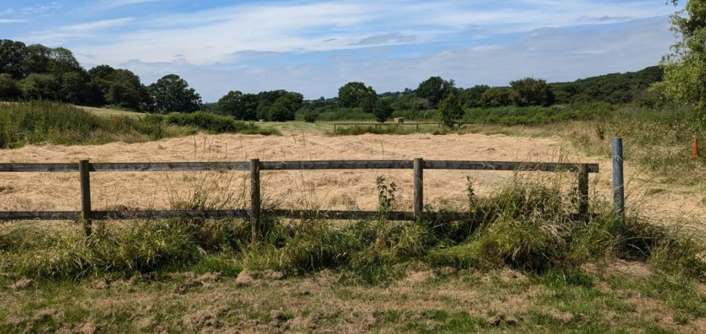
The Green Belt is a designated area of land around towns and cities where development is strictly controlled to prevent urban sprawl, protect the countryside and maintain the separation between settlements.
Yet despite its prominence in planning decisions, it remains one of the most misunderstood concepts in English town planning.
Millions of people live near it, own land within it, or have had planning applications refused because of it — with only a vague sense of what protections it actually carries and, crucially, what it does not.
This article addresses four foundational questions:
where the Green Belt came from and how it is governed today;
what the five statutory purposes of the Green Belt are;
how Green Belt is designated and how much of England it covers; and
how it differs from other countryside designations.
Where Did the Green Belt Come From?
The concept of a green belt around London was first given statutory force by the Green Belt (London and Home Counties) Act 1938.
However, it was the 1955 Ministry of Housing Circular 42/55 that transformed Green Belt from a London-specific idea into a national planning tool — instructing local authorities across England to define their own Green Belts in their development plans.
Planning Policy Guidance Note 2 (PPG2), first issued in 1988 and substantially revised in 1995, set out the purposes and policies that became deeply embedded in planning practice.
When the Coalition Government replaced the entire suite of PPG and PPS documents with the National Planning Policy Framework in March 2012, the core Green Belt policies were carried over substantially intact — a deliberate political signal of their enduring importance.
The December 2024 NPPF represents the most significant revision to Green Belt policy since the designation era. It introduces the concept of 'Grey Belt', places new obligations on local authorities to review Green Belt boundaries to meet housing need, and establishes 'Golden Rules' for development on released land.
The fundamental architecture of Green Belt policy has remained constant: once designated, boundaries should be altered only in exceptional circumstances through the development plan process, and development within the Green Belt is inappropriate unless it falls within one of a defined set of exceptions.
What Are the Five Purposes of the Green Belt?
Paragraph 143 of the December 2024 NPPF sets out the five purposes of the Green Belt.
They are the benchmarks against which boundary changes must be justified, the framework for assessing whether land makes a sufficient contribution to warrant continued Green Belt status, and — following the 2024 reforms — the criteria for determining whether land qualifies as Grey Belt.
Understanding each purpose in depth is essential to any serious engagement with Green Belt policy.
Purpose (a): To check the unrestricted sprawl of large built-up areas
This is the original and still dominant purpose of the Green Belt.
The term 'sprawl' is not defined in the NPPF — it is a matter of planning judgement in each case.
What the courts and inspectors have consistently emphasised is that this purpose is concerned with the general pattern of outward urban growth, not simply the physical impact of any single scheme.
A parcel of land on the urban fringe can score strongly against this purpose even if it offers little visual or ecological value.
The relevance is locational and functional: does this land, if developed, contribute to the outward march of the built-up area in a way that erodes the integrity of the Green Belt boundary?
Purpose (b): To prevent neighbouring towns from merging into one another
This purpose is often highly site-specific. It applies most acutely to land in the gaps between settlements — what is sometimes called the 'coalescence'.
The key considerations are the width and character of the remaining gap, the degree to which development would visually and physically reduce the perceived separation between the two settlements, and whether a sense of distinct identity would be lost.
Decision makers have often found against proposals on this purpose where the gap between two towns was already narrow and any further encroachment would create a nearly continuous built form.
The test is not simply whether the two settlements would literally touch, but whether the sense of separation that gives each its distinct identity would be materially eroded.
Purpose (c): To assist in safeguarding the countryside from encroachment
This purpose is widely misunderstood. It is about encroachment — the intrusion of an urban character into rural land — rather than landscape quality or ecological value per se.
Land does not need to be attractive, productive or ecologically sensitive to score against this purpose.
Scrubby, degraded or visually unremarkable land can serve it perfectly well, provided its rural character and openness would be lost to development.
The question is whether development would constitute an encroachment of the urban into the rural — a functional and spatial question, not an aesthetic one. Applicants who argue that their site is 'scrubland' or 'of no landscape value' routinely find that this carries little weight against purpose (c).
Purpose (d): To preserve the setting and special character of historic towns
The least frequently applied of the five purposes in day-to-day decision-making, but one of considerable importance in the right context.
It applies principally around historic cities and market towns whose character and legibility depend substantially on their relationship with open countryside.
The test os often whether the openness of the surrounding Green Belt makes a material contribution to preserving that character and setting.
Purpose (e): To assist in urban regeneration by encouraging the recycling of derelict and other urban land
This is the most counterintuitive of the five purposes, and the one most frequently overlooked by applicants.
The purpose is systemic rather than site-specific — it reflects the policy rationale for containment itself.
How Much Green Belt Is There, and How Is It Designated?
England currently has approximately 1.6 million hectares of designated Green Belt, accounting for around 12.5% of the total land area.
It is not evenly distributed.
The largest Green Belt by far is the Metropolitan Green Belt surrounding London, which extends across parts of Essex, Hertfordshire, Buckinghamshire, Berkshire, Surrey and Kent.
Beyond London, significant Green Belts exist around the West Midlands, Greater Manchester and Merseyside, West and South Yorkshire, Tyne and Wear, and a number of other cities including Bristol, Oxford, Cambridge, Gloucester, York and Burton upon Trent.
Designation is a function of local planning authorities, carried out through the development plan process.
Local plans must define Green Belt boundaries clearly, using physical features that are readily recognisable and likely to be permanent (NPPF, paragraph 149(f)).
Once established, the NPPF requires that boundaries are maintained unless exceptional circumstances are fully evidenced and justified through a local plan review.
New Green Belts can be established — the NPPF does not prevent this — but the bar is high and the circumstances are narrow.
Villages within the Green Belt present a particular designatory challenge.
The NPPF (paragraph 150) addresses this directly: where it is necessary to restrict development in a village primarily because of its contribution to the openness of the Green Belt, the village should be included within the Green Belt.
In practice, many local plans inset villages from the Green Belt, with the consequence that the settlement boundary policy — rather than Green Belt policy — governs development within them.
Green Belt, National Landscapes, National Parks and Countryside Policies: What Is the Difference?
One of the most common misunderstandings we encounter is the conflation of the Green Belt with other countryside and landscape designations.
These are distinct policy regimes with different purposes, and different consequences for development.
Green Belt
As set out above, the Green Belt is a spatial planning tool, not a landscape quality designation.
It says nothing about the scenic beauty, ecological value or agricultural productivity of the land within it.
A scrubby field on the edge of a motorway junction can be Green Belt.
The policy is concerned with location, function and the containment of urban growth — not with the appearance or character of the land itself.
National Landscapes (formerly Areas of Outstanding Natural Beauty)
National Landscapes — rebranded from Areas of Outstanding Natural Beauty (AONBs) under the Levelling-Up and Regeneration Act 2023 — are designated on the basis of the exceptional scenic beauty of the landscape.
The statutory purpose of their designation is to conserve and enhance that natural beauty.
National Landscapes apply in rural areas, often remote from city fringes, and there is often no overlap with Green Belt.
The NPPF affords significant weight to the protection of National Landscapes — paragraph 182 requires that great weight is given to conserving and enhancing the landscape and scenic beauty in these areas.
Development that would harm the special qualities that justified the designation is likely to be refused, regardless of whether the land is also Green Belt.
National Parks
National Parks carry the strongest statutory landscape and heritage protection in England.
Their purposes — set out in the Environment Act 1995 — are the conservation and enhancement of natural beauty, wildlife and cultural heritage, and the promotion of opportunities for the public understanding and enjoyment of their special qualities.
National Parks have their own planning authorities.
Major development proposals within them are subject to a specific policy test under paragraph 190 of the NPPF, which applies a strong presumption against approval unless exceptional circumstances can be demonstrated and the development is in the public interest.
Very few National Parks areas are also Green Belt — the designations occupy different geographies.
Sites of Special Scientific Interest (SSSIs)
SSSIs are ecological and geological designations, managed by Natural England under the Wildlife and Countryside Act 1981 (as amended).
They apply to land of special interest by reason of its flora, fauna, geological or physiographical features.
Designation has direct legal consequences: certain operations on SSSI land require Natural England's consent, and harmful development proposals will trigger a formal consultation with Natural England, whose objection carries substantial weight.
General Countryside and Outside Settlement Boundary Policies
This is perhaps the most important — and most frequently overlooked — additional layer of protection for sites outside the Green Belt.
The vast majority of local development plans contain policies that restrict development in the open countryside or outside defined settlement boundaries. This policy is separate of Green Belt policy.
These policies go by various names: 'open countryside policies', 'rural area policies', 'outside settlement boundary' policies, or simply 'development in the countryside' policies.
These policies matter for a straightforward reason:
a site can be outside the Green Belt — and therefore not subject to the Green Belt's presumption against inappropriate development,
While still being subject to strong policy restraint under the development plan's general countryside policy.
For landowners and applicants in areas without Green Belt designation, this is not a green light for development. The absence of Green Belt simply means that the Green Belt policy framework does not apply; it does not mean that development is acceptable in principle.
The scope and strength of these policies varies considerably between local planning authority areas.
Some are drawn narrowly, applying only to open land with no existing development context. Others are drawn broadly, applying to all land outside named settlement boundaries and carrying a strong presumption against development except for specified exceptions.
In areas where the five-year housing land supply test applies, the weight of these policies may be reduced.
The relationship between Green Belt policy and general countryside policy can be complex.
In some local authority areas, the Green Belt boundary broadly coincides with the settlement boundary — so land outside the settlement is both Green Belt and governed by the countryside policy.
In others, particularly around larger settlements, there may be areas that are outside the settlement boundary and subject to countryside policy but not within the Green Belt.
Conservation Areas and Listed Buildings
Heritage designations — Conservation Areas designated under the Planning (Listed Buildings and Conservation Areas) Act 1990, and the listing of buildings — apply within and outside Green Belt.
They are concerned with built character and historic significance rather than open land.
Development within a Green Belt Conservation Area must satisfy both Green Belt policy and heritage policy.
In many cases, the heritage policy will be the more strict test, particularly where the conservation area designation was applied to protect the historic character of a village or market town.
What Has Changed Under the December 2024 NPPF?
The December 2024 NPPF introduces the most significant changes to Green Belt policy since the national designation framework was established. Three changes are of particular importance.
The introduction of Grey Belt
The NPPF now defines a new category of land — Grey Belt.
Grey Belt is land in the Green Belt comprising previously developed land and any other parcels or areas that make a limited contribution to the five Green Belt purposes.
This is a significant conceptual shift.
For the first time, the NPPF provides a route for development on Green Belt land that is not dependent on demonstrating very special circumstances, provided the land meets the Grey Belt definition and the Golden Rules are satisfied.
The obligation to review Green Belt
Under the 2024 NPPF, local planning authorities that cannot demonstrate they can meet their identified housing needs — including the new Standard Method figure — without amending Green Belt boundaries are expected to review those boundaries as part of their plan preparation.
This reverses the previous approach, under which Green Belt review was discretionary even where housing need was unmet.
The Golden Rules
Development on land released from the Green Belt — whether through a plan review or on Grey Belt land at appeal — must meet the Golden Rules set out in paragraph 156 of the 2024 NPPF.
This is a fast-moving area of policy. The December 2024 NPPF changes are still working through the system — local plan examinations, appeals and emerging case law will define how Grey Belt operates in practice over the coming years.
Green Belt Summary
The Green Belt is a spatial planning tool whose primary purpose is urban containment, not landscape protection.
It was established through post-war planning policy and is now governed by the NPPF, which sets out five distinct purposes against which all Green Belt land must be assessed.
Understanding these fundamentals is the foundation for any serious assessment of development potential in or near the Green Belt — whether you are a landowner, a developer, a local authority or a community group.
Planning Application Advice
If you own land or a building in the Green Belt and want to understand your development options, I can advise on planning strategy and manage your application from initial assessment through to decision. Contact me to discuss your site.
Andrew Ransome MRTPI - Email: andrew@andrewransome.co.uk
About me
Andrew Ransome is a Planning Director and a Chartered Member of the Royal Town Planning Institute (RTPI), with more than two decades of experience in town planning.
He specialises in delivering strategic planning solutions for complex developments across both rural and urban environments, helping clients navigate planning challenges and unlock development opportunities. Connect with Andrew on Linkedin.


Green Belt Information
Green Belt Approvals
Get in touch for planning advice: Email: andrew@andrewransome.co.uk
© 2026. All rights reserved.